Home | Front Page | Blog | Index | New | Contact | Site Map
Vientiane
Vang Vieng
Luang Prabang
To Phonsavane & back
Plain of Jars
Pathet Lao War
Luang Nam Tha
Guest Houses
Foto Show

China 2001
Vietnam 2001
Laos 2001
Thailand 2001
Cambodia 2001
Britain 2001
USA 2001
Click on photos to open them full size.
We left the car in the cool of the early morning and started walking through the low grass up a small hill. As we crested the hill, we saw a dark smudge maybe ten meters away, then another and another until we realized that this was it ó we had arrived. The dark smudges were huge rough stone containers; they were none other than the jars for which the Plain of Jars is named. They looked a bit like giant squat ginger jars sans lids and fifty to a hundred of them varying in size from three feet to six feet across and from four feet to ten feet high are scattered on the brow of the hill. They are in no apparent order or shape. Mostly rounded they sit open to the sky empty of all but a few weeds and maybe the remnants of a recent rainfall. Archaeologists are still uncertain of their use, but the consensus seems to be that they were burial jars and are 2000+ years old.
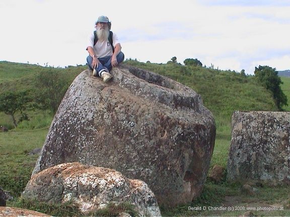
Gerry on jar at Site 1 |
The three of us (Gerry and I had been joined by Jennifer Ovens, a Canadian tour guide, for the duration of our trip to the Plain of Jars) had the entire place to ourselves, just us and the jars. The only sound was the crunch of the grass underfoot and the click and whirr of camera shutters and motors. This was what we had been travelling for three days to see. With the sun still low in the sky, we took advantage of the softer morning light and snapped away to our heartís content. Having exhausted the first hill, we caught sight of a second, slightly higher one and another collection.
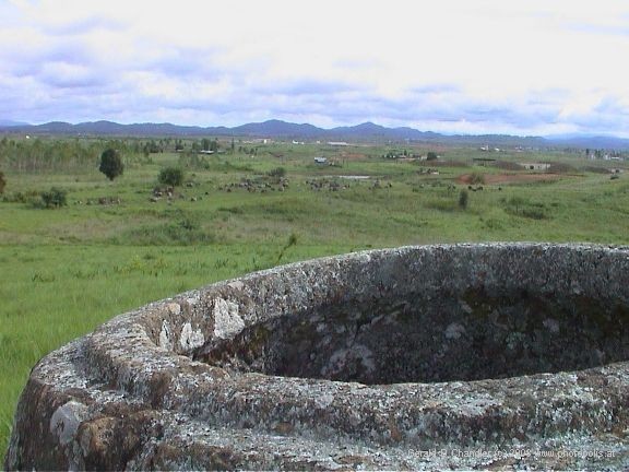
Jars at Site 1 |
On a very full day exploring the Phonsavane area, we visited the three best known jar sites called, very originally, Sites 1, 2, and 3. All of them were situated on one or more of the areaís rolling hills. The jars on Site 1 were in two groups, each group on a hill, the second hill overlooking the first. On the higher of the two hills we found obvious bomb craters and jars split into two by what must have been the kind of severe impact caused by a bomb. At the time we speculated that the bombs must have been targeting some anti-aircraft position as this was the highest hill around.
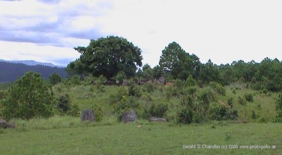
Jars at Site 2 |
Site 2 consisted of two hills facing each other across a gulley. It was here that we encountered a group of archeologists working on mapping the site and measuring each of the jars and their relative placement.
The lead architect was a Belgian woman, based in Hong Kong, who was on secondment in Laos for only a few months. She said she was extremely pleased to be working here and she thought coming here would be any archaeologists dream.
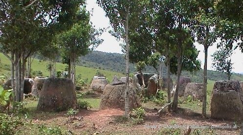
Jars at Site 3 |
Site 3 was under a grove of trees on the side of a hill surrounded on three sides by rice paddies through which we had walked to get to the site. The hill behind the site afforded a wonderful panoramic view of the area blessedly free of air pollution and sparkling under a deep blue sky punctuated with fluffy white scudding clouds.
The first thing you should know about the Plain of Jars is that it is not a plain. Certainly not in the sense of the great plains of the American midwest. Rather it is a fertile area of low rolling hills about 20 miles wide and 25 miles long ringed with high mountains. Perhaps in contrast to the precipitous peaks of these mountains it does seem flat, but a plain it is not.
The main town in the area, Phonsavane, is a very strange mixture of expensive tourist resort and hardship backpacker outpost. The only two ways to get here are by plane (hence for high-priced tourists) or via a tortuous two or three day journey by road. The city itself holds little of interest and is a rather drab modern city without charm. The city has no long history having been built after the civil war ended to serve as the provincial capital.
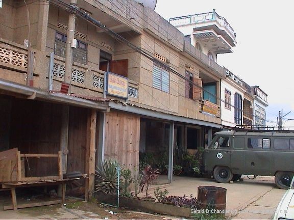
Guesthouse in Phonsavane |
The local tourist industry derives its income from providing 4-WD cars, drivers, and guides for tours to the sites and so has a vested interest in making access to them seem difficult and discouraging self-guided tours. We, however, had arrived in town with our own vehicle and driver and figured that our Lonely Planet guidebook was probably more than adequate to guide us through the sites.
The situation must have struck horror into the soul of our hotel keeper, Mr. Sousath of the Maly Hotel. He suggested without any subtlety that Chanthi, our driver, might be arrested and fined if discovered serving as an unlicensed tour guide. We responded that he was only a driver not a guide. Mr. Sousath may also have tried to subvert Chanthi directly by telling him that the sites could not be accessed with his minivan and/or that he was being vastly underpaid by these rich foreigners and didnít he know he was being exploited. Fortunately, however, good sense prevailed and Chanthi drove us as planned to all three sites and more besides with no adverse consequences beyond the usual end of day fatigue. The lack of signage to the sites did cause Chanthi some problems, but generally he would stop a local, ask one or two questions and quickly find his way.
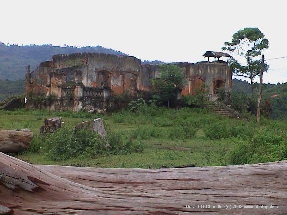
Xieng Khoung bombsite |
Apart from the jar sites, we also visited two towns/villages near Phonsavane. One, Xieng Khoung town was the provincial capital before the civil war and according to the propaganda was bombed out of existence by those nasty Americans. Of course what they fail to explain is that the town was the headquarters of the Vietnamese army (no, thatís not a typo) in the area as it is very close to the Ho Chi Minh trail. As explained by Weldon in his memoir about Laos, this area was overrun by the Vietnamese and their Pathet Lao allies during the civil war and only then became a target for bombing raids to take out anti-aircraft positions to protect U.S. planes flying from North Vietnam bombing runs back to their bases in Thailand. The local propaganda makes it all sound as though U.S. action was entirely unprovoked. Furthermore, the town does still exist.
The second village, Meung Sing, was on what we came to think of as the infamous Route 7. When we first planned the trip to Phonsavane we had noticed on the map that the distance to Phonsavane was much shorter via Route 7 than via Routes 4/1/6. In our original conversation with our driver Chanthi we thought he had understood and agreed to take us via Route 7 and bring us back the long way via Nam Neun and Nong Khiaew. Alas, when we came to finalize the details, he made it clear that he would not, indeed could not drive his van on Route 7. Gerry determined to see for himself the state of Route 7, hence the visit to Meung Sing. The 30 km of road from Phonsavane to Meung Sing is brand new and so in tip-top condition. Unfortunately, in Meung Sing the road changes from brand new modern highway to graded dirt road as it winds through the village of wooden stilt houses and then as it leaves the village and passes instead through rice fields, it degrades into a dirt track with ruts in places five feet deep.
We all found it a bit frustrating to think that only 60km away this road would meet Highway 4, the main road from Vientiane to Luang Prabang. Even on roads like those that brought us here, it would take no more than a couple of hours. Yet we would have to drive for two to three days to get there. Hell, we could almost walk to Luang Prabang in two days from here. But it was not to be, so we contented ourselves instead with the pleasure of wandering past rice paddies where the owners were transplanting new seedlings.
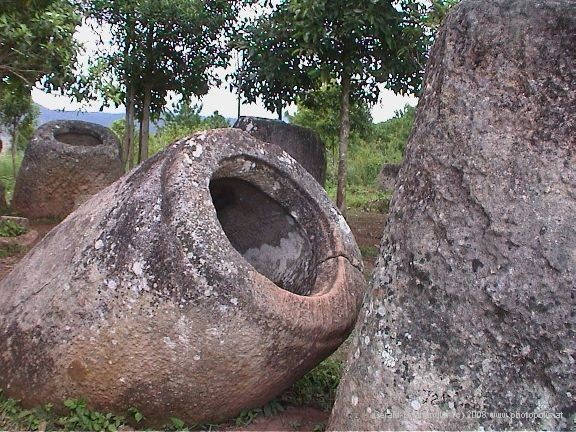
Jars from Site 2 |
And so ended our visit to the Plain of Jars. It had been interesting, for sure, but for Gerry and me there is no question that interesting as it was, getting there and back was much more than half the fun.