Home | Front Page | Blog | Index | New | Contact | Site Map
Parral
Madera
Cuarenta Casas
Paquime
Basaseachi Falls
Copper Canyon
Arepo & Urique Canyon
Guachochi
Sinforosa
Guadalupe y Calvo
Parral
Foto Show
NuevoLeon
Coahuila
Chihuahua
Sonora
Durango
Jalisco
Sinaloa
Zacatecas
San Luis Potosi
Queretaro
Guanajuato
Michoacan
Guerrero
Morelos
Puebla
Tlaxcala
Oaxaca
Chiapas
Campeche
Yucatan
Quintana Roo
Teotenango
Xochicalco
Monte Alban
Mitla
Palenque
Uxmal
Chichen Itza
Tolum
Belize Mayans
Tikal
Copan
General Topics
Churches
Beach Bumming
Swimming Along
States
Websites
Map
Car Costs
> USA-Britain
USA 2003
USA 2002
Britain 2002
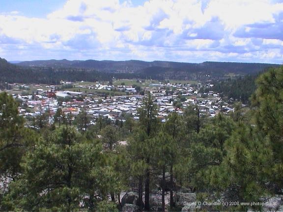
Creel, Chihuahua |
We approached Creel from the west, the direction of the Basaseachi Waterfall. Creel is a small mountain town dedicated to tourism. Named after the founder of the Copper Canyon railroad, it is where almost all visitors to the canyon spend at least a day or so. It is also the jumping off point for hikers and cyclists and of course the omnipresent foreign backpacker. It's a clean, friendly town that is bisected by the railroad tracks and organized around the three or four daily train arrivals. It has a couple of museums that diverted us for an hour or two and a range of restaurants to suit every possible taste.
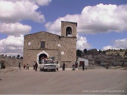
Tarahumara Church |
Our first excursion from Creel was to the Tarahumara reservation/cum tourist park of San Ignacio, several square kilometers about 5 kms from Creel with a small church and an artificial lake. Equipped with a tourist sketch map that was hard to relate to the poor road maps that we owned, we set off one morning to walk there and back. The hardest thing was to find the right road out of town, but once that was done it was a straight shot up and over a small hill to the park entrance where we paid our 15 peso entrance fees.
Our first stop was Cueva de Sebastien, Sebastien's cave, a large cave in which a family of Indians had built rough lean-to type huts where they lived and hawked souvenirs to tourists like us. Jan couldn't resist and picked up a very colorful cotton shawl and a rather attractive two-tone woven reed basket. From there we cut across country to the main road to San Ignacio church our next destination.
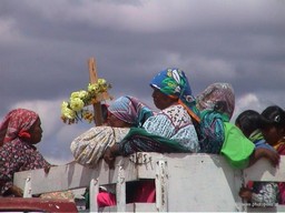
Cueva de Sebastien |
While we walked we were passed by a couple of tourist Jeeps who stopped and gave us directions to the church. The dirt road we were on climbed gently up to an area of strange shaped rocks and from there we could look down into a transverse valley and at one end of the valley was a small settlement that included a white building with a tower that looked just like the church we were looking for. And, indeed it was. San Ignacio was a small stone building that looked sort of Scottish from a distance. It had a single long hall furnished only with benches around the walls where we sat and watched as Indian families wandered in bringing with them what looked like donations for a harvest festival. When we tried to ask what they were for, we were told, gifts. Soon thereafter, we could guess that they were donations to a wake, because two trucks arrived bearing a coffin and grieving family members for a funeral.
Being in the creel area was our first close encounter with any of Mexico's many Indian tribes. They reminded us very strongly of the hill-tribes we had seen in northwest Vietnam and northern Laos. Physically they were similar, but there were other resemblances too. Like the hill-tribes, the Tarahumara like to dress in colorful clothes. Liked to keep to themselves and not mix too much in mainstream society except to sell handicrafts and the like.
But we did not want to intrude on this sad occasion, so we left the churchyard and headed for a nearby hill over which we hoped to find the trail to Lake Arrerego. A hundred yards from the church, we noticed another group of Indians on the hillside and guessed that they were digging or in some way preparing the grave. We also met several people coming from the direction we were going and in our poor Spanish tried to ask if we were on the road to Arrerego. As best we could understand we were, although when we crested the hill we got some conflicing information from a man who seemed to suggest that we strike out across some fields but we weren't sure why or exactly where. We were on a very well-trodden path so we stuck with it as it hugged the hillside of a wide valley until after about 45 minutes to an hour it deadended at a gate to what looked like a farm. With no other choice but to trespass, we opened the gate and walked down to another well-trodden path that wound between cornfields. There was a young girl working in one of the fields who seemed very shy at our approach but when asked where the road to Arrerego was simply motioned with her head in the direction we were walking. We weren't sure whether to believe her but sure enough in five more minutes we saw a low wall with a gate through it and beyond the Lake parking lot and then the lake itself.
We spent a pleasant hour eating a small picnic lunch which we shared with some Indian kids who were trying to sell bead necklaces to the tourists and then we walked back partway along the main highway and then cutting through the tourist park again to the church, where people were still gathered by the graveside on the hill opposite. By the time we got back to town we were pretty tired but with a better appreciation of the area. The next day we took a break from Creel to go visit Areponapuchi and another part of the Copper Canyon Area, the Urique Canyon.
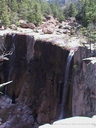
Cusarare waterfall near Creel, Chihuahua |
When we got back from Creel, we took two different day trips to sights near Creel. The first was to Cusarare waterfall. The directions in LP were detailed enough, but you never quite know before you get there whether they are clear or not. This time they were fine and we pulled off the road and followed a dirt trail to an enormous parking lot that was totally devoid of cars and a building that housed a snack bar that was also empty. We donned our hiking boots, locked up the car and set off through cornfields to walk to the falls. The trail was pretty easy. It wandered along a narrow valley to the main valley and then followed the stream down to the fall. And there we were disappointed. The trickle of water in the stream did not translate into the pretty curtain of water we had seen in photos of the sight. Nonetheless we had fun climbing out onto the top of the falls and then down to its foot. We even walked downstream along the valley hoping to get to one of the big canyons, but the trail petered out and we had to give up and come back. Back at the fall we ran into a young man with a ponytail called Sandro. He and his wife Yvonne were riding their bicycles from San Francisco to Chile. We walked back with him to his bike and then went on back to our car and back to Creel.
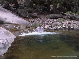
Recowata thermal springs pool |
Two days later, on Sandro's recommendation we took the hike to Recowata thermal hot springs. We drove as far as the paved road would take us and then parked the car, locked it, and hiked along the most uncomfortable stone road out to the edge of the canyon and then down a dozen switchbacks to the bottom of the valley. The road then followed the river downstream to the thermal springs complex which consisted of changing cabins, a picnic pavilion, and two manmade bathing pools, painted blue inside to look like regular swimming pools but with what looked like black stains all over them. We, however, had learned from Sandro that there were much more attractive natural pools further downstream. Our only problem was how to find them. We didn't fancy climbing over the big boulders that lined the river bank as they looked a bit slick, so instead we climbed up the bank and found a very narrow trail that we followed up, over, and down to the natural pools. There we stripped down to bathing suits and went for a dip in the largest of the pools. The water was pleasantly warm rather than hot because the spring water was mixed in with stream water. After drying off in the sunshine, we got dressed, climbed back over to the main area to eat our lunch in the shade of a tree. Walking back up the stone road we felt a few drops of rain. By the time we were halfway up we were in the middle of a drenching rainstorm. Even with umbrellas and raincoats we still got wet. But by the time we made it all the way back up the hill, it was dry again and the sun was back out as we drove back to Creel.
