Home | Front Page | Index | Blog | New | Contact | Site Map
California | Photos | Map
Los Angeles:
Doings | Eatin' | Bldgs | More | Hancock Park
Caltech:
Campus | Reunion | Lloyd House | JPL
Yosemite Valley
Yosemite Falls
Nevada Fall

Britain 2002
USA 2001
USA 2002
USA 2003
Virginia
North Carolina
South Carolina
Georgia
Florida
Alabama
Louisiana
Texas
Arizona
California
Nevada
Index 1999-2002
Index 2002-2003
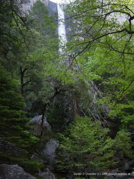
Yosemite - Bridal Veil Fall |
Our Yosemite experience began in Modesto, California, where we spent an afternoon outfitting ourselves for four our five days of camping. After equipping ourselves with tent, airbed, sleeping bags, cooking kit, and food staples we drove on to Merced, a closer gateway to Yosemite.
We left Merced for Yosemite very early in the morning as we wanted to get there in time to get one of the campsites for which no reservations are needed (nor possible).
Our drive up the valley of the Merced River was rewarded with many sights of boiling rapids, fed by rapidly melting snow in the high Sierras. It was immediately obvious that we were in for a treat: the flow of water in all of the falls must be tremendous.
We drove into the park on the El Portal side and happily showed our National Parks Pass to gain entrance. [We had purchased the pass way back in Appomattox, Virginia, gambling that the $50 purchase price would save us money — the gamble paid off here in Yosemite.] Soon we were in the valley proper and within a few miles we caught sight of Bridal Veil Fall, the most accessible waterfall in the park (see photo left). It was gorgeous.
But even strong temptation did not make us stop. Our concentration was on getting a place to rest under the stars. (Okay, not directly; there would be a tent to keep out the mosquitos. But our tent &mdash yes, it's true &mdash has a skylight.
At the park's Camping Reservation office we first tried for a reserved site, hoping there would be at least one no-show. No such luck. Rather than any sites being free, there was a negative number available: the Merced River was at such a high stage that parts of the campgrounds were flooded; the unfortunate occupiers of these sites were relocated and crowded onto others.
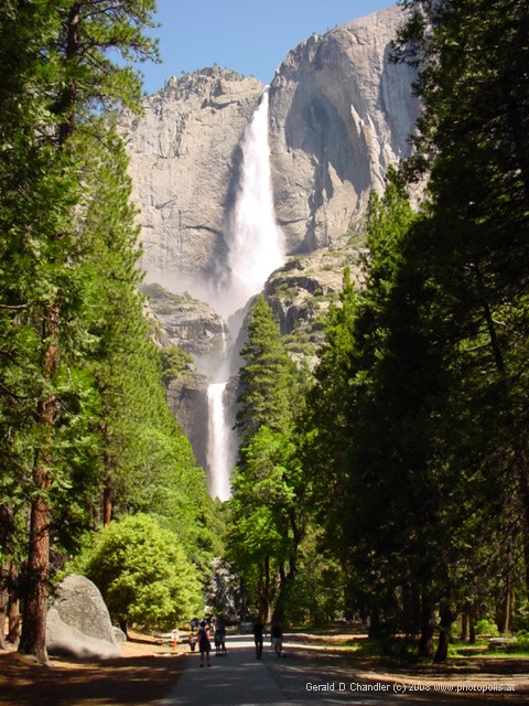
Yosemite Falls |
But wait! as many TV ads say. That's not all. As we were about to leave the camping office, they got a call from Camp 4 that thirty sites (i.e., places for 30 people) were available. Camp 4, located almost at the base of Yosemite Fall, is the one where reservations are not allowed; people may stay up to a week and must check out by 10:00. Thus, at 10:00 a definitive inventory is available and we were in the office just at the moment it became available. We immediately drove the two miles to Camp 4 and got our space with no waiting in line. (In the next few days we would learn that every morning at 6:30 a.m. or so a line formed.)
Getting Settled
Camp 4 is what is called "walk-in" — campers must park their cars in a lot and carry their goods to the tent site. For us that meant a walk of a few hundred yards/meters. Each tent site can accommodate up to 6 people in as many tents as needed/can fit. On our site there were at most four tents served by two fire rings, two picnic tables, and four bear boxes. No, the bear boxes are not for keeping bears corralled. Rather, they are for storing all food and toiletries so that bears don't bother people in tents or try to destroy cars to get at food or food-like products that their very strong sense of smell alerts them to. The boxes are heavy metal and have a closing mechanism that is bear-proof. During our stay we neither saw sight nor sign of any bear, to Gerry's deep disappointment.
The tent went up quickly because of our late night practice in Merced (showing that the techniques Gerry teaches about software development can be applied to other fields) and we filled it with the king size air mattress and our two cheap polyester sleeping bags (good down to 40 F for Gerry and 30 F for Jan). Then we had a second breakfast (to complement the rushed one we had eaten in the car) with the roar of Yosemite falls in the background. Once breakfast was over we set off for an easy hike.
As usual our navigational skills were sharp as a tack. We intended to walk west, toward the entrance of the valley, by crossing the Swinging Bridge. In only a few hundred yards we were convinced it was underwater (it wasn't or else was an reappeared three days later) and that we had better go the other way. Heading east we could hear the roar of Yosemite Falls getting louder and louder. Then we caught a glimpse of it. And then a better one. And then we saw all of both falls in their majesty.
Valley Excursions
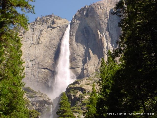
Upper Yosemite Falls |
Soon we were at the bottom of the falls. It's a tourist spot, but don't be deceived by that appelation. No matter how many people are around you, no matter how crowded it might be, your attention can only be on the falls when it flows like we saw it. We stood on a bridge, faced the falls, stretched out our hands, put our face forward, and had a titanic experience.
From there we walked/hiked along the north side of the valley, skirting the Vistor Center, and came to the Ahwahnee hotel. It is a gorgeous place, but at $350-$800 per day we were glad we skipped it. (Gerry's older brother Richard and his wife, Louise, had spent part of their honeymoon there. Gerry never found out what they thought about the fact that after they had checked in his parents, grandmother, grandfather, aunt, and uncle showed up. Did they think they were in a Noel Coward play?)
A wonderful benefit of stopping at the Ahwahnee was to learn that fresh, correctly dated New York Times were available in the Valley. So we bought one and saved it to accompany our picnic.That took place about a mile farther along, at Mirror Lake. There, we sat by the water and admired the view as well as read about world events. The view, unfortunately, doesn't quite live up to Gerry's memory. It is probably because there has been a lot of silting of the lake and there are no longer broad expanses of water.
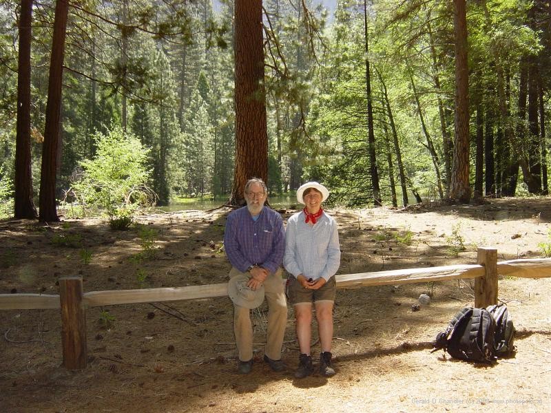
Rest and Relaxation |
The next day we hiked the route Happy Isles - Vernal Falls Bridge &mdash Vernal Falls &mdash Nevada Fall. The photo above,taken from Washburn point, shows most of our route. We took the shuttle bus from Camp Four and set out, Gerry knowing we would make it to the top of Nevada Fall and Jan being surprised when, halfway there, she learned that we were going farther. The valley floor is about 4,000 feet high and the top of Nevada Fall is a rise of about 2,500 feet.
Two days and a reasonable rest later we hiked to the top of Yosemite Falls. That's about 3000 feet up and 3000 feet down, with a 7 mile round-trip walk. The walk up is somewhat exposed so we were treated to and hindered by the direct sun. Slowly but surely we made progress. The farther we got the better the views became. Our first acheivement was to arrive at Columbia Rock where we got a great view of the valley. Soon after that we got a great shock: the trail descends, perhaps as much as 300 feet. We knew that when we came back the re-ascent of these 300 feet would be a major obstacle for tired bodies.
Mariposa, Wawona, and Washburn
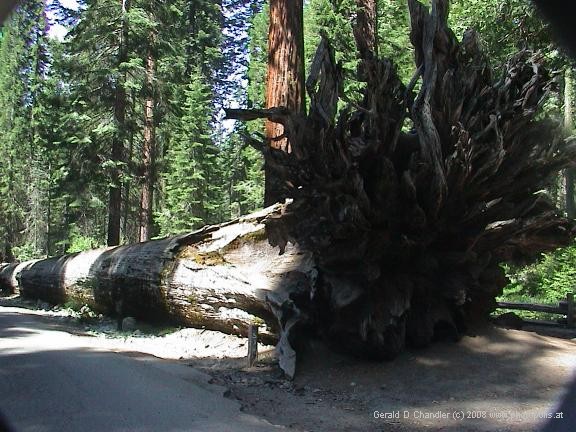
Mariposa Grove fallen Sequoia with Roots |
Our final excursion was to the Mariposa Grove which we expected to be a leisurely walk in the woods. In the end, however, we made a 7-mile hike through the lower and upper groves and out to Wawona Point for a picnic and then back to the car. We came back from this walk almost as tired as from the Yosemite Falls hike; which just meant we still hadn't recovered completely.
One of the first things you see in the lower grove is the fallen giant (shown adjacent). There is an old photo that shows about 100 mounted soldiers on top of and to the left of this tree. We found the upper Mariposa Grove with its several dozen large sequoias much more impressive than the Muir Woods and well worth the excursion.
On the way back to Yosemite Valley we drove up to Washburn and Glacier Points. The views there, especially of our route up to Nevada falls was almost overwhelming. We have pictures of it because we met Theo, a diplomat from the German embassy, who at Gerry's request kindly took some pictures for us on our memory stick using his Sony digital camera. In fact, all of the pictures shown here of Yosemite were taken on other peoples cameras.
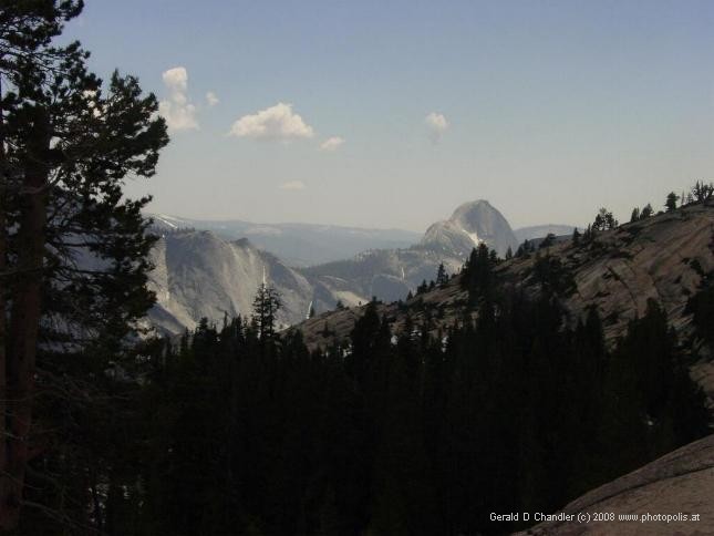
View of Half Dome from Olmstead Point on Tioga Pass road |
Saying Goodbye
We left Yosemite by the Tioga Pass road, which had been closed on our arrival; we were lucky that it opened just two days before we left. There we had wonderful views again most memorably from Olmstead Point where, mirabile dictu, it rained! The picture shows the back side of Half Dome. Just to its left, invisible, are Nevada and Vernal Falls. Equally invisible, to its right is the location of Mirror Lake.
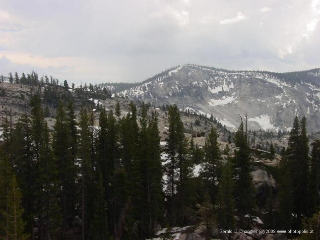
Olmstead Point View of upper Yosemite in partial snow |
As we drove along the Tioga Road we saw more and more snow. Not enough that it covers the hills, but enough that we had a clear idea where the masses of water that feed the falls come from. And, it was clear how lucky we were. In a few more days, at most, the snow melt would taper off and the falls would start their slide into dormancy.