Home | Front Page | Blog | Index | New | Contact | Site Map
Antalya (April 1-8; 12-15)
Kalechi
Perge
Aspendos
Termessos
East of Antalya (8-12)
Side
Anamur
Antioch Ad Cragum
Alanya
Lycia (15-25)
Tekirova -
Phaselis
Myra(Kale)
Kekova
Kas
Xanthos
Fethiye
Kara - Oludeniz
Lycian Way
Datça Peninsula (25-2)
Greek Cities (May 2-18)
Selçuk -
Ephesus
Izmir -
Smyrna
Bergama -
Pergamon
Ayvalik
Assos
Troy
Ataturk Country (17-24)

Egypt
Israel
Turkey
Bulgaria
Romania
Ukraine
Poland
Prague
Britain
USA 2002
Travel Map

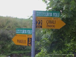
Lycian Way Signpost |
On our first or second night in Antalya, sitting around reading a magazine we found at Ani Pension, we learned about the Lycian Way. While Lycia is a very old place, the Lycian Way is a very recent creation. It is almost the work of a single person: a young doctor who loved Turkey and loved to walk. Through dint of persistent effort she got the cooperation of local authorities to define and mark the trail. Often it is along the old, unpaved road that literally hugged the coast of Lycia. Less than twenty years ago this road was replaced by a more modern highway, usually a few kilometers inland. Sometimes, however, it passes near or even through private lands and here it is not yet completely welcome as we would learn.
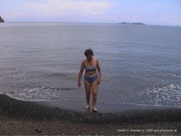
Once knowing about the Way, we wanted to hike as much of it as we could. Eventually we found time to do three short segments. The first was from Tekirova. We found it by accident one rainy afternoon when we took a short walk from our all-inclusive hotel. We returned a day or so later once we had changed hotels and had a completely free day. The walk was not terribly difficult although it had us puffing a little bit on the road up out of Tekirova that climbed over a spit of land and dropped us down into the next bay. That's where Jan got her first taste of the Mediterranean on the trip. It looked so inviting (in spite of the black sand), but oh it was so cold!

Emerging from a Chilly Dip |
It was on the way back to Tekirova that we bumped into another hiking couple who hailed from Chemnitz near Dresden. We left them wishing that we could be in two places at once as their neck of the woods sounded quite delightful. Perhaps when we go to Prague we'll border hop and visit them.
Our second excursion on the Way was from Kas. We had a map that showed the trail, but when the trail markers disappeared, the accompanying written instructions did not alwayss help us find our mistake. One reason was that the trail had been deliberately obstructed with large piles of cut brush. Our map showed two alternate trails and for a while we thought that perhaps one alternate had been closed because it was too dangerous, but then we decided that the more likely answer was that the local farmer or farmer wasn't happy having hikers tramping over his land.
The weather was more cooperative with us on this hike and we had bright warm sunshine the entire day. We ended our segment of the hike on a very narrow rocky ledge that had both of us feeling a bit nervous. Instead we found a nearby ledge and sat and enjoyed our packed lunch while admiring the ocean views it gave us. During lunch we were passed by a group of hikers coming towards Kas. They headed off about fifteen minutes in front of us. We next found them swimming in a small cove below the trail. In spite of Jan's earlier experience, the warm weather encouraged us to do likewise. We should have known, however, that one or two days of sunshine do not an ocean heat. We made it into the water but didn't survive there for very long. And then we had the problem of finding the continuation of the trail back to Kas. We were following the alternate trail and were rather shocked to find that it took us up what seemed to us like a sheer rock face to get back onto the cliff top from the beach. In spite of our nerves we both made it safely and as reward got wonderful views of the ocean and of Kas off in the distance.
The third and final segment was the shortest of all. We discovered it by accident as it skirted the archeological remains of Xanthos where we were tramping around to see what there was to be seen on the outer edges of the site.